

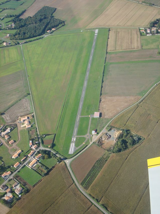
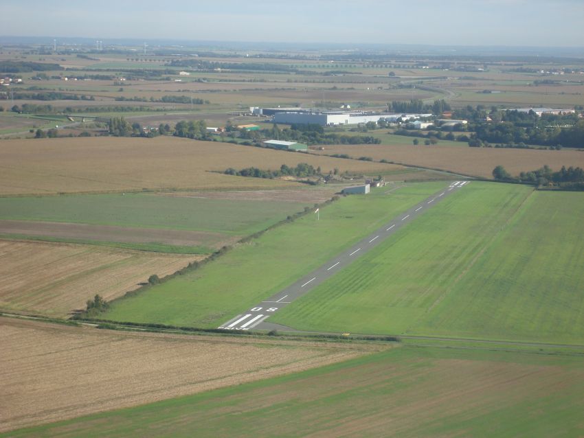
THE RUNWAYS
N46° 27' 43" - W1° 14' 30"
Runway 08-26 – 760M x 12M (Tarmac)
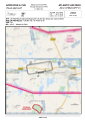
Visual Approach Chart (VAC)
WARNING!
02 JULY 2026 - THE TARMAC RUNWAY WILL BE CLOSED FOR MAINTENANCE. PILOTS TO BE VIGILANT IF USING THE GRASS RUNWAY.
We have scheduled the painting of yellow lines on the taxiways and entrances, and installing lot numbering.
BIRDS AND POSSIBLE PRESENCE OF LARGE ANIMALS (DEER/WILD BOARS) WITH DAMAGE TO GRASS RUNWAY. PLEASE CHECK WITH A RESIDENT PILOT BEFORE USE.
The area between the grass runway and the tarmac runway is mowed but not rolled. We draw your attention to this fact and warn that you can inadvertently end up in this area because of the absence of any runway markings. We therefore suggest that you do not use this area unless it is absolutely necessary and at your own risk. In the event of an incident, AAP cannot be held responsible.

The safety and usage instructions are here.
.jpg)
Displaced threshold marked by white lines across the runway, inboard of the numbers.
- Radio: "Atlantic Air Park" 123.50 Mhz (French only)
- Circuits: 700' AAL to the north (Avoid over flying the local villages and hamlets)
-Visual Approach Chart (Click here)
France is a flyer’s paradise, with airfields and airports almost everywhere. Situated on the west coast of France, it makes an ideal launch pad, for aerial expeditions, in almost any direction! Spain is less than two hours away (C172 or PA28), The Atlantic coastal islands: Ile d’Oleron, Ile d’Yeu and Belle Ile are all less than an hour’s flight.
One of the particular delights of flying south of 50N, is the number of accessible aerodromes that have excellent restaurants. In the immediate region, try out La Roche-sur-Yon (LFRI), Poitiers (LFBI), Cholet (LFOU), Royan (LFCY), Leognan Saucats (LFSC), Libourne (LFDI), St Foy Le Grande (LFDF) Angers (LFJR) and Ancenis (LFFI). These are great for a meal or a fly-out. Montalivet and Soulac in the Gironde are good coastal destinations too.
Flight Planning
www.sia.aviation-civile.gouv.fr is the site for official aeronautical information about flying in France. Most sections of the SIA site are also available in English and it is possible to download current VFR and IRF approach and landing charts for virtually every aerodrome in the country.
https://sofia-briefing.aviation-civile.gouv.fr/sofia/pages/homepage.html is a comprehensive flight planning tool for private pilots. Available in French and English. It provides access to weather, route planning and NOTAMS. It is possible to file, amend and cancel flight plans. When the flight plan is validated, you will receive a confirmation number.
Close Your Flight Plan!
Normally, ATC will not cancel flight plans, for aircraft inbound to non-controlled airfields – ours being an example. There is a national number available to facilitate closing flight plans, after arrival. (01 56 301 301), and, you can opt to be answered in French or English. IF YOU DO NOT CLOSE YOUR FLIGHT PLAN, YOU MIGHT FACE HUGE CHARGES, FOR SEARCH COSTS.
METEO
www.aviation.meteo.fr provides a first class aviation weather briefing service.